
The best interactive wall maps turn geography into an activity rather than a static display. Depending on the design, children can learn through sound and quizzes, while families and travelers can mark places they have visited.
This roundup compares talking maps, magnetic displays, push-pin travel maps, and laminated classroom sets, with attention to age range, size, durability, and educational value.
Best 10 Interactive Wall Maps Picks for 2026
Best Bilingual Learning Pick

- English- and Spanish-language learning
- 3,500 facts covering 195 countries
- Audio pen includes recording features
Best For: Bilingual geography learning for children ages 3 to 12
Best U.S. Travel Display
Home Magnetics Interactive Map

- Framed United States map
- Includes 30 marker pins
- Large 46-by-34-inch format
Best For: Pin-based travel tracking and decorative U.S. geography display
Best Touch-Activated Quiz Map
BEST LEARNING i-Poster My World

- Touch-activated country audio
- Over 1,000 spoken geography facts
- Ten quiz-and-learn modes
Best For: Self-contained geography practice for children ages 5 to 12
Best World Travel Tracker

- Framed 44-by-34-inch world map
- Includes 90 push pins
- Designed for travel tracking and wall decor
Best For: Marking visited destinations in a home or office
Top Pick for Young Explorers

- English-and-Spanish interactive learning
- 2,000 facts and 10 activity modes
- Includes games and creative recording features
Best For: Children ages 3–12 exploring U.S. geography
Best World Map Activity Set

- Covers 195 countries and 3,500 facts
- Includes 15 quizzes in three levels
- Roll-up map with music and recording extras
Best For: Children ages 5–12 learning world geography
Best Simple Map Display
Laminated World & U.S. Map Set
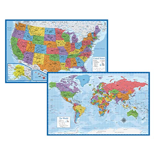
- Includes world and U.S. posters
- Large 18-by-29-inch chart size
- 3 mil laminated, tear-resistant finish
Best For: Durable visual reference at home or school
Interactive Pick

- Touch-activated facts, quizzes, and state information
- Includes 300+ questions and four learning modes
- Works on a wall or floor with batteries included
Best For: Hands-on U.S. geography learning for ages 5–12
Preschool Poster Set
United States & World Map for Kids
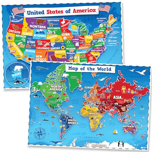
- Two-map set with USA and world posters
- Waterproof, tear-resistant PVC material
- Dry-erase surface supports reusable lessons
Best For: Early geography learning in classrooms, playrooms, and homeschool spaces
Three-Poster Value Set
World, U.S. & Solar System Maps

- Combines world, U.S., and solar system posters
- Adds flags, fun facts, and other extra details
- Laminated and dry-erase compatible
Best For: Broad geography and astronomy display in classrooms or homeschool rooms
Best Bilingual Learning Pick – Qiaojoy Interactive World Map
For families seeking interactive wall maps that combine geography practice with hands-on play, the Qiaojoy Bilingual World Map offers English- and Spanish-language learning for children ages 3 to 12. Its audio pen adds spoken facts, recording, and personalized sound features.
Best For: Young learners and bilingual households exploring countries, cultures, and geography through guided audio activities.
Pros:
- Supports English and Spanish learning.
- Covers 3,500 facts about 195 countries, including capitals, flags, languages, animals, and oceans.
- Includes an audio pen with recording and personalized startup sound functions.
- Designed for geography, memory, and cognitive skill development.
Cons:
- Requires using the included audio pen for the interactive features.
- The educational content is aimed primarily at children ages 3 to 12.
This is a strong choice when spoken content and bilingual learning matter more than decorative wall art. The recording feature also gives children a creative way to personalize play.
Best U.S. Travel Display – Home Magnetics Interactive Map
Among interactive wall maps, this framed United States map is a decorative option for tracking places with removable marker pins. Its 46-by-34-inch format is sized to function as both geographic wall art and a visual travel display.
Best For: Homes, offices, or classrooms that want a framed U.S. map for marking destinations and displaying geographic interests.
Pros:
- Framed design provides a finished wall-art presentation.
- Includes 30 marker pins for interactive marking.
- Large 46-by-34-inch size offers substantial map visibility.
Cons:
- Focuses on the United States rather than the whole world.
- Supplied notes do not indicate spoken facts, quizzes, or electronic learning features.
This map is better suited to visual exploration and travel marking than audio-based instruction. Choose it when presentation and pin-based interaction are the main priorities.
Best Touch-Activated Quiz Map – BEST LEARNING i-Poster My World
For buyers comparing interactive wall maps for structured geography practice, the BEST LEARNING i-Poster My World uses touch activation rather than a separate pen or app. Children can press countries to hear facts and use ten quiz-and-learn modes.
Best For: Children ages 5 to 12, homeschool settings, and classrooms needing self-contained geography practice.
Pros:
- Touch any of 92 countries to hear spoken information.
- Includes more than 1,000 facts about capitals, flags, landmarks, languages, and populations.
- Offers ten quiz-and-learn modes for geography and memory practice.
- Includes three AAA batteries and five volume levels.
Cons:
- The map covers 92 countries, so coverage is more limited than some world maps.
- It is designed primarily for ages 5 to 12.
- The included manufacturer warranty is 90 days from purchase.
This is a practical pick for families wanting immediate, low-prep interaction: touch the map, hear the information, and switch to a quiz mode. Its wipe-clean construction also suits repeated indoor use.
Best World Travel Tracker – Winding Hills Magnetic Map
Among interactive wall maps designed as decor, the Winding Hills Designs magnetic world map combines a taupe framed finish with 90 push pins. It is intended for recording travel and marking places visited in living rooms, bedrooms, or offices.
Best For: Travelers who want a large framed world map to use as a visual travel tracker and conversation piece.
Pros:
- Large 44-by-34-inch framed world map.
- Includes 90 push pins for marking destinations.
- Taupe design is positioned as wall art for several room types.
- Lighter magnetic pins are designed to hold firmly to the map.
Cons:
- Not designed to hold larger or heavier gift-shop magnets.
- The supplied notes describe travel tracking rather than educational audio or quiz functions.
This model fits buyers prioritizing travel memories and room decor over child-focused instruction. Its generous pin count makes it especially useful for marking many destinations over time.
Top Pick for Young Explorers – Qiaojoy Bilingual U.S. Map
For families seeking interactive wall maps that combine geography with hands-on play, the Qiaojoy V2 focuses on the United States and supports both English and Spanish learning. Its talking-pen design, games, recording function, and broad mix of state facts make it more engaging than a standard poster.
Best For: Children ages 3–12 who are learning U.S. geography, culture, and history in English or Spanish.
Pros:
- Bilingual content with more than 2,000 facts and 10 interactive features.
- Includes state and capital information alongside animals, culture, history, and other facts.
- Three progressive game modes support memory, matching, and reflection skills.
- Recording and personalized startup-sound functions encourage creative play.
Cons:
- Focuses on the United States rather than world geography.
- Requires two AAA batteries.
- The product is designed for one player at a time.
This is a strong choice when you want an interactive U.S. map with substantial content and language flexibility. The added audio, games, and recording features should hold attention better than a traditional wall chart.
Best World Map Activity Set – Goldge Talking World Map
The Goldge is one of the more feature-rich interactive wall maps for children who are ready to explore beyond the United States. It pairs a talking pen with country facts, music, quizzes, and creative extras, while the roll-up format makes storage easier between learning sessions.
Best For: Children ages 5–12 who want an interactive introduction to countries, capitals, flags, animals, and world music.
Pros:
- Covers all 195 countries with 3,500 facts and 15 quizzes.
- Offers three difficulty levels for gradual skill building.
- Includes a talking pen, piano music card, and recordable greeting card.
- Roll-up construction and protective packaging support storage and gifting.
Cons:
- The listed paper dimensions are relatively narrow at 12.5 by 25 inches.
- The feature-packed set may be more than younger children need.
Choose this set if global coverage and variety are priorities. Its quizzes and audio content give children multiple ways to revisit the map, while the roll-up design is practical for homes or classrooms.
Best Simple Map Display – Laminated World & U.S. Map Set
For shoppers who want interactive wall maps in the broadest, display-focused sense, this laminated two-poster set provides both world and U.S. maps without electronics. Each 18-by-29-inch chart uses 3 mil lamination for added durability and tear resistance, making it suitable for everyday reference.
Best For: Homes, classrooms, or study areas that need durable world and U.S. map posters for visual reference.
Pros:
- Includes both a world map and a United States map.
- Large 18-by-29-inch format is easy to display and consult.
- 3 mil lamination helps resist tears and everyday wear.
- Made in the USA according to the supplied product notes.
Cons:
- Does not include a talking pen, quizzes, games, or other interactive electronics.
- The supplied notes do not specify bilingual content or additional learning activities.
This set is best viewed as a durable visual foundation rather than an electronic learning toy. It is a sensible pick when you want two large reference posters and prefer low-maintenance, battery-free materials.
Interactive Pick – BEST LEARNING i-Poster My USA
For children who learn best by doing, this interactive wall map turns U.S. geography into a hands-on activity. Touch points provide spoken facts, quizzes, capitals, cities, landmarks, and additional learning modes for ages 5 to 12.
Best For: Homeschool lessons, classroom practice, and kids who enjoy audio-guided geography games.
Pros:
- Offers 51 touch locations, including the states and Washington, D.C.
- Includes more than 300 quiz questions across basic to advanced levels.
- Supports geography, memory, concentration, logical thinking, and problem solving.
- Comes with batteries, an illustrated guide, five volume levels, and flexible wall-or-floor use.
Cons:
- Focuses on the United States rather than world geography.
- Requires three AAA batteries for operation.
- The manufacturer warranty is limited to 90 days from purchase.
This is the most interactive option in the group, making it a strong choice when passive display maps are not enough. Its quizzes and spoken feedback add structured practice, while the large poster format keeps the activity easy to access.
Preschool Poster Set – United States & World Map for Kids
This two-piece set is a straightforward choice for adding interactive wall maps to a preschool, playroom, or homeschool space. The colorful USA and world posters use clear labels and artist-drawn icons, while the waterproof PVC surface can be used with dry-erase markers.
Best For: Toddlers, preschool classrooms, playrooms, and early visual geography activities.
Pros:
- Includes both a United States map and a world map.
- Bright illustrations and clear labeling support visual learning.
- Waterproof, tear-resistant PVC construction is designed for repeated use.
- Dry-erase compatibility allows reusable, interactive lessons.
Cons:
- At 24 by 16 inches, each poster may provide less detail than a larger map.
- Unframed posters require a separate mounting solution.
- Designed for early learning, so older students may want more advanced reference detail.
Choose this set when durability and simple visual presentation matter more than electronic features. Having both U.S. and world maps makes it especially practical for introducing broad geography concepts to young learners.
Three-Poster Value Set – World, U.S. & Solar System Maps
This three-poster bundle combines geography and astronomy in a compact format. Along with a world map and United States map, it includes a solar system poster, extra features such as state flags and fun facts, and laminated surfaces suited to classroom or homeschool display.
Best For: Families and educators wanting several educational wall posters in one affordable, space-conscious set.
Pros:
- Includes world, United States, and solar system posters.
- Features extras such as state flags, a Europe inset, Pluto, and fun facts.
- Double-sided flush lamination adds water resistance and supports dry-erase use.
- Suitable for toddlers through adults as classroom, homeschool, or bedroom decor.
Cons:
- Each poster measures 14 by 19.5 inches, so map details are relatively compact.
- The posters are unframed and require wall-mounting supplies.
- Paper construction may be less rugged than a plastic poster.
This set offers the broadest subject coverage of these interactive wall maps, with geography and astronomy in one package. Its laminated, dry-erasable finish adds flexibility for teaching, although the smaller dimensions favor supplementary learning over detailed reference use.
How We Picked the Best Interactive Wall Maps
We evaluated these Interactive Wall Maps by looking at the type of interaction they provide, the intended age range, map coverage, display size, materials, and practical setup requirements. Talking maps and electronic posters can support independent learning, while magnetic and push-pin maps are better suited to hands-on exploration, travel tracking, or family discussion.
We also considered whether each format works best in a bedroom, playroom, classroom, office, or shared family space. A map should be readable from a useful viewing distance and durable enough for the way it will be handled.
Quick Comparison
| Map type | Best for | Main advantage | Watch for |
|---|---|---|---|
| Talking world map | Early learners | Audio facts, pronunciation, and quizzes | Requires batteries and may need supervision |
| Talking United States map | U.S. geography practice | Focused state and regional learning | Limited global coverage |
| Magnetic map | Hands-on learning and travel tracking | Reusable markers and movable pieces | Needs wall space and secure mounting |
| Push-pin map | Travelers and families | Visual record of visited places | Pins may not suit young children |
| Laminated poster set | Classrooms and budget displays | Simple, lightweight, and easy to wipe clean | Usually has no electronic interaction |
Key Buying Factors for Interactive Wall Maps
Interaction and Learning Style
Choose audio, quizzes, or a talking pen if the main goal is guided learning. For open-ended play and travel memories, magnets or push pins offer more physical interaction without electronics.
Age and Safety
Check the recommended age and the size of included accessories. Small pins and magnets can be unsuitable for toddlers and should be kept away from children who may swallow them. Electronic models may also require adult help with batteries or settings.
Map Size and Readability
Measure the available wall before ordering. Larger framed maps are easier to read across a room, while compact posters work well on a desk, door, or crowded classroom wall. Look for clearly labeled states, countries, oceans, and major landmarks.
Materials and Installation
Framed magnetic maps provide a finished display but are heavier and may need stronger hardware. Laminated posters are lighter and easier to replace. Confirm whether hanging hardware, markers, pins, batteries, or a talking pen are included.
Who Should Buy Which Interactive Wall Maps?
For young children: Choose a talking world map with age-appropriate controls, clear audio, and a durable surface.
For U.S. geography practice: A dedicated interactive United States map can make state names, capitals, landmarks, and regional facts easier to review.
For travelers: Pick a framed magnetic or push-pin world map with enough markers to record multiple destinations over time.
For classrooms: Laminated world and U.S. map sets are practical when you need lightweight charts that can withstand frequent handling.
For a decorative display: A framed magnetic map combines educational value with a more finished look for an office, family room, or home learning area.