
The best wall maps under $100 can turn an empty wall into a useful reference point, conversation starter, or educational display. This roundup includes compact U.S. maps, large world maps, laminated charts, and coordinated map sets for different spaces and budgets.
We focused on map size, readability, material, geographic presentation, and display flexibility so you can choose a map that fits your wall and intended use—not just the largest design available.
Best 10 Wall Maps Under 100 Picks for 2026
Decorative Global Reference
Rand McNally Classic World Map

- Africa-centered projection keeps countries intact
- Laminated and dry-erase compatible
- Antique styling with topographical relief
Best For: Offices, classrooms, and polished home decor
Detailed U.S. Reference
National Geographic U.S. Wall Map

- Covers all 50 states with helpful insets
- Includes roads, parks, cities, and physical features
- Readable colors with shaded terrain relief
Best For: Detailed U.S. geography and travel planning
Extra-Large Classroom Display

- Massive single-sheet 46-by-80-inch format
- 2026 political map with shaded relief
- Laminated for write-on, wipe-clean use
Best For: Large classrooms and high-visibility displays
Classic U.S. Wall Display

- Large 32-by-50-inch U.S. format
- Vivid colors with blue oceans
- Laminated poster with visual 3D relief
Best For: Bold home, office, or classroom displays
Best Overall Reference Map
Executive Laminated World Wall Map

- Detailed political and physical geography
- Winkel Tripel projection minimizes distortion
- Durable 1.6 mil laminate
Best For: Traditional, information-rich world map displays
Best Value Map Set
Laminated World and USA Map Posters

- Includes world and USA maps
- Equal Earth design shows relative continent size
- 3 mil laminated, tear-resistant posters
Best For: Flexible two-map displays in smaller spaces
Best Colorful Display
Decorator Laminated World Wall Map

- Vibrant country colors aid identification
- Detailed physical and political features
- Durable laminated 46 x 30.5-inch format
Best For: Colorful home, classroom, or office displays
Portable Classic
Swiftmaps World Premier Wall Map

- Folds to 8 x 10 inches for portability
- 3D shaded relief for land and oceans
- 24 x 36-inch current political map
Best For: Portable classroom, home, or office display
Durable Duo
Laminated World and US Map Set
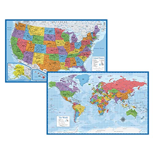
- Includes world and U.S. maps
- 3 MIL laminated and tear resistant
- 18 x 29-inch posters made in the USA
Best For: Compact, durable dual-map reference
Large Learning Set
24x36 Laminated World and USA Map Set

- Two large 24 x 36-inch maps
- Laminated for dry-erase use
- 3D terrain relief on world and U.S. maps
Best For: Large educational or office displays
Decorative Global Reference – Rand McNally Classic World Map
If you want wall maps under 100 that look polished enough for an office or study, the Rand McNally Classic Edition combines antique-style decor with current geographic reference details. Its laminated 50-by-32-inch format is large enough for everyday viewing without taking over an entire wall.
Best For: Home offices, classrooms, conference rooms, and buyers who want a decorative world map with practical reference value.
Pros:
- Africa-centered projection shows continents and countries intact without the usual map splits.
- Laminated surface resists scuffs and fingerprints and works with dry-erase markers.
- Color-matched topographical relief highlights major mountain ranges, plateaus, and basins.
- Ships rolled in a sturdy tube for crease-free delivery.
Cons:
- The 50-by-32-inch size requires a reasonably open wall area.
- Antique-style accents may not suit minimalist or brightly modern rooms.
This is a strong all-purpose choice when presentation matters as much as map detail. The distinctive projection and durable laminated finish make it especially useful for teaching, planning, and casual global reference.
Detailed U.S. Reference – National Geographic U.S. Wall Map
Among wall maps under 100, this National Geographic United States map is a practical pick for readers who need broad U.S. coverage with substantial place and transportation detail. The 43.5-by-30.5-inch sheet uses clear colors, shaded relief, and carefully placed labels for everyday reference.
Best For: Students, travelers, educators, and households wanting a detailed map of all 50 states.
Pros:
- Includes all 50 states with Alaska and Hawaii insets plus an Alaska size comparison.
- Shows cities, boundaries, national parks, physical features, and thousands of place names.
- Includes interstate highways, state routes, airports, waterways, canals, and ferries.
- Shaded relief identifies mountain ranges and valleys while keeping the palette readable.
Cons:
- The supplied notes do not specify lamination, so surface protection may be limited.
- Its detailed layout can be more information-dense than a simple decorative map.
This map favors information over ornament. If your priority is seeing U.S. geography, transportation routes, parks, and populated areas on one wall, its National Geographic design is a dependable reference-oriented option.
Extra-Large Classroom Display – Giant 46 x 80 World Map
Giant World Map - Mega-Map Of The World 46 x 80 - Laminated - 2026 Updated | Maps International
Check Price On AmazonFor buyers comparing wall maps under 100 by usable display area, the Giant World Map stands out with its enormous 46-by-80-inch single-sheet format. It combines a political world layout with colored countries, cities, hill and sea shading, and a laminated surface designed for repeated classroom use.
Best For: Classrooms, large study spaces, offices, and anyone who wants a highly visible world map.
Pros:
- Extra-large 46-by-80-inch size makes the map easy to see across a room.
- 2026 update includes colored countries, towns, cities, and shaded terrain and seas.
- Industrial-quality lamination supports writing with whiteboard pens and wiping clean.
- Rolled tube delivery helps prevent creases.
Cons:
- The 80-inch width needs substantial wall space and careful placement.
- Its very large format may be impractical for smaller rooms.
This is the best fit when visual scale is the main requirement. Its write-on finish adds useful flexibility for lessons, presentations, and route or location marking, provided you have enough wall space.
Classic U.S. Wall Display – Swiftmaps 32×50 U.S. Map
Swiftmaps 32x50 United States Classic Premier Blue Oceans 3D Wall Map Poster (Laminated)
Check Price On AmazonIf you need wall maps under 100 focused on the United States, the Swiftmaps Classic Premier offers a large 32-by-50-inch display with vivid color, blue oceans, and visual 3D relief. Its two-sided lamination is designed to add durability to the poster-style map.
Best For: Homes, offices, classrooms, and U.S.-focused displays that need a bold, easy-to-view format.
Pros:
- Large 32-by-50-inch size provides substantial U.S. geographic coverage.
- Current political map styling uses vivid colors and blue oceans for visual contrast.
- Visual 3D relief adds dimension to the terrain presentation.
- Two-sided lamination helps protect the poster surface.
Cons:
- The glossy finish may create reflections under strong lighting.
- The supplied notes do not list specific cities, routes, or other map features.
This Swiftmaps option is a straightforward choice for a prominent U.S. wall display. It prioritizes size, color, durability, and terrain presentation rather than the extensive feature list of a highly detailed reference map.
Best Overall Reference Map – Executive Laminated World Wall Map
For shoppers comparing wall maps under 100, this National Geographic Executive map stands out as a detailed, durable reference display. Its antique-style palette, shaded relief, carefully placed place names, and 1.6 mil laminate make it suitable for both study and long-term display.
Best For: Buyers who want a highly detailed world reference map with a traditional executive look.
Pros:
- Includes detailed political and physical features, including cities, boundaries, waterways, airports, and bathymetry.
- Uses the Winkel Tripel projection to reduce distortion between continents.
- Heavy-duty laminate resists humidity-related swelling and shrinking and can be framed without glass.
- Includes inset maps covering vegetation, land use, population density, and polar regions.
Cons:
- The antique-style palette may be less vibrant than a decorator-style map.
- Its 46 x 30.5-inch size requires substantial wall space.
This is the strongest choice for buyers prioritizing authoritative geographic detail, durability, and a classic presentation over a bright decorative color scheme.
Best Value Map Set – Laminated World and USA Map Posters
If you want wall maps under 100 for more than one location, this two-poster set offers a practical combination of a world map and a USA map. Both 18 x 29-inch posters use 3 mil lamination for added durability and tear resistance.
Best For: Buyers seeking an affordable two-map setup for classrooms, offices, bedrooms, or study areas.
Pros:
- Includes both a world map and a USA map.
- Equal Earth world-map design presents continents at their true relative size.
- 3 mil lamination adds durability and tear resistance.
- Compact 18 x 29-inch format is easier to place than a large wall map.
Cons:
- The supplied notes provide fewer geographic-detail specifications than the National Geographic maps.
- The set may offer less wall coverage because each poster is smaller.
This set is a sensible pick when versatility and having two coordinated maps matter more than maximum detail or a large presentation format.
Best Colorful Display – Decorator Laminated World Wall Map
Among wall maps under 100, the National Geographic Decorator edition is a strong choice for buyers who want reference information with a more colorful presentation. Its vibrant country colors, shaded relief, extensive labeling, and laminated 46 x 30.5-inch format work well as both decor and a learning tool.
Best For: Buyers who want an eye-catching world map that remains detailed enough for reference use.
Pros:
- Vibrant colors make individual countries easier to distinguish.
- Shows international boundaries, cities, islands, airports, waterways, and physical features.
- Winkel Tripel projection helps limit visual distortion.
- 1.6 mil laminate improves durability and allows framing without glass.
Cons:
- The large 46 x 30.5-inch format needs a generously sized wall.
- The colorful style may not suit buyers seeking a subdued or antique appearance.
Choose this edition when visual impact is important but you still want National Geographic’s researched geographic information and durable laminated construction.
Portable Classic – Swiftmaps World Premier Wall Map
If you want wall maps under 100 that are easy to store or transport, this folded Swiftmaps world map is a practical choice. The 24-by-36-inch political map folds to approximately 8 by 10 inches and uses shaded relief to show terrain across land and oceans.
Best For: Home offices, classrooms, businesses, and anyone who needs a portable world map.
Pros:
- Folds to a compact 8-by-10-inch size for storage or transport.
- Features 3D shaded visual relief for land and oceans.
- Designed for business, home, or educational use.
- Printed on coated 24-pound paper.
Cons:
- Paper construction is less durable than a laminated map.
- The folded format may show creases when displayed.
This is a solid budget-friendly pick when portability matters more than maximum durability. Its full 24-by-36-inch format provides useful wall coverage while the folded design makes it convenient to put away.
Durable Duo – Laminated World and US Map Set
For shoppers comparing wall maps under 100, this two-poster set combines a world map and a United States map in a manageable 18-by-29-inch format. Each poster has 3 MIL lamination, adding tear resistance for regular display and handling.
Best For: Homes, classrooms, and offices that need both world and U.S. geographic reference maps.
Pros:
- Includes both a world map and a United States map.
- 3 MIL lamination helps protect against tears.
- Compact 18-by-29-inch size fits smaller wall spaces.
- Updated posters are made in the USA.
Cons:
- Smaller than the 24-by-36-inch options in this roundup.
- The supplied details do not indicate dry-erase compatibility.
This set is a sensible choice when versatility and durability are more important than oversized presentation. Having two maps also makes it useful for side-by-side reference without buying separate products.
Large Learning Set – 24×36 Laminated World and USA Map Set
This laminated two-map set is a strong contender among wall maps under 100 for buyers who want large, readable displays. It includes 24-by-36-inch world and United States maps, each printed on 100-pound paper with 3D terrain relief and a dry-erase-friendly laminated surface.
Best For: Educational spaces, offices, and homes that need large world and U.S. maps for repeated reference.
Pros:
- Includes large 24-by-36-inch world and U.S. maps.
- Laminated surface supports dry-erase use.
- Uses 3D visual terrain relief on both maps.
- Designed for business, home, or educational settings.
Cons:
- Requires more wall space than the 18-by-29-inch set.
- The larger two-map format may be less convenient to store.
If visibility and repeat use are priorities, this set offers the most substantial display format of the three. Lamination adds practicality, while the matching world and U.S. maps create a useful reference pair.
How We Picked the Best Wall Maps Under 100
We compared the selected maps by geographic coverage, dimensions, construction, visual clarity, and likely use. Laminated options received extra consideration because they are easier to wipe clean, resist everyday handling, and generally hold up better in classrooms, offices, playrooms, and busy homes. We also included paper options for shoppers who prioritize a lower price, lighter weight, or a mural-style presentation.
The selection covers traditional reference maps, decorative designs, oversized world maps, U.S. maps, and bundled world-and-country sets. Because map accuracy and update dates can vary, check the product listing for the current edition, labeling style, and included geographic details before buying.
Quick Comparison
| Best For | Look For | Recommended Type |
|---|---|---|
| Detailed reference use | Clear labels and a larger physical size | Executive or classic laminated map |
| Large blank-wall coverage | Oversized dimensions and easy mounting | Mega-size world map |
| U.S. geography | State boundaries, cities, and readable typography | Dedicated U.S. wall map |
| Teaching or family use | Durable surface and broad coverage | Laminated world-and-U.S. set |
| Decorative display | Color palette and projection style | Decorator or mural-style map |
Key Buying Factors for Wall Maps Under $100
Size and Viewing Distance
Measure the wall before ordering, including space for frames, rails, or mounting hardware. A small map may be easier to place but can be difficult to read from across a room. Oversized maps create stronger visual impact, though they need a wide, relatively unobstructed wall.
Lamination and Mounting
Lamination is useful for classrooms, kitchens, children’s rooms, and offices where the map may be touched or exposed to occasional moisture. Confirm whether the map arrives rolled or folded. Rolled maps usually produce a cleaner display, while folded maps are easier to ship and store but may show creases.
Projection, Colors, and Labeling
Map projections affect the apparent size and shape of continents. Some designs emphasize conventional visual familiarity, while Equal Earth-style layouts aim for more balanced relative area. Choose high-contrast colors and readable type if the map is intended for study; select muted or antique-style colors if decoration is the priority.
Coverage and Update Information
For reference use, check whether the map includes state or national borders, major cities, physical features, capitals, time zones, or current geographic naming. A stated update year can be helpful, but it should not replace checking the actual listing details and map preview.
Who Should Buy Which Wall Maps Under 100?
Teachers and families should favor laminated maps or sets that combine world and U.S. coverage. Office and home decorators may prefer a decorator, classic, or antique-style design that complements existing furniture. Students and geography enthusiasts should prioritize readable labels, accurate boundaries, and a larger size rather than purely decorative styling. Shoppers filling a large wall should consider an oversized world map, while anyone with limited space may get more flexibility from a standard 18-by-29-inch set or a dedicated U.S. map.
Before purchasing, compare the map’s finished dimensions with your wall, verify whether it is laminated, and decide how you will mount it. Those practical details often matter as much as the design when choosing among the best wall maps under $100.